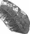
Static Map Catalogue - Full Metadata Record
Collection QuickBird-2
QuickBird-2. More details.
QB2_OPER_BGI_PAN_MP_20090603T102945_N45-553_E007-523_0001
Download Product | BrowsePath | E007 |
Row | N45 |
Start Date | 2009-06-03T10:29:45.907Z |
Stop Date | 2009-06-03T10:29:45.907Z |
Availability Time | 2009-06-03T10:29:45.907Z |
Instrument Short Name | BGI |
Sensor Type | OPTICAL |
Sensor Mode | PAN |
Orbit number | 0 |
Illumination Azimuth Angle | 147.8 |
Illumination Elevation Angle | 64.1 |
Footprint | 45.58271016 7.48576810 45.52389085 7.48734724 45.52485476 7.56196415 45.58367604 7.56046284 45.58271016 7.48576810 |
Scene Centre | 45.5537890337 7.52388566507 |
Size | 96588672 |
Acquisition Type | NOMINAL |
Product Type | BGI_PAN_MP |
Cloud-Cover Percentage | 0 |
Resolution | 0.6 |
Processing Level | other: LV3A |
Bounding Box | 45.58367604 7.4857681 45.52389085 7.4857681 45.52389085 7.56196415 45.58367604 7.56196415 |
Scale | 1:50.000 Orthorectified |
Satellite | QuickBird-2 |
