Static Map Catalogue - Full Metadata Record
Collection QuickBird-2
QuickBird-2. More details.
QB2_OPER_BGI_PAN_MP_20030706T102234_N45-573_E007-220_0001
Download Product | Browse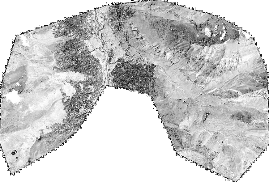
Path | E007 |
Row | N45 |
Start Date | 2003-07-06T10:22:34.695Z |
Stop Date | 2003-07-06T10:22:34.695Z |
Availability Time | 2003-07-06T10:22:34.695Z |
Instrument Short Name | BGI |
Sensor Type | OPTICAL |
Sensor Mode | PAN |
Orbit number | 0 |
Illumination Azimuth Angle | 140.6 |
Illumination Elevation Angle | 62.9 |
Footprint | 45.59581646 7.17231268 45.55043664 7.17378456 45.55192263 7.26920074 45.59730480 7.26780567 45.59581646 7.17231268 |
Scene Centre | 45.5738800719 7.22077557015 |
Size | 88181208 |
Acquisition Type | NOMINAL |
Product Type | BGI_PAN_MP |
Cloud-Cover Percentage | -99900 |
Resolution | 0.6 |
Processing Level | other: LV3A |
Bounding Box | 45.5973048 7.17231268 45.55043664 7.17231268 45.55043664 7.26920074 45.5973048 7.26920074 |
Scale | 1:50.000 Orthorectified |
Satellite | QuickBird-2 |