Static Map Catalogue - Full Metadata Record
Collection QuickBird-2
QuickBird-2. More details.
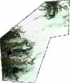
QB2_OPER_BGI_4B__MP_20090625T110638_N61-694_E006-912_0001
Download Product | BrowsePath | E006 |
Row | N61 |
Start Date | 2009-06-25T11:06:38.410Z |
Stop Date | 2009-06-25T11:06:38.410Z |
Availability Time | 2009-06-25T11:06:38.410Z |
Instrument Short Name | BGI |
Sensor Type | OPTICAL |
Sensor Mode | PM |
Orbit number | 0 |
Illumination Azimuth Angle | 169.5 |
Illumination Elevation Angle | 51.5 |
Footprint | 61.74028124 6.82555961 61.64553083 6.83221880 61.64807204 6.99903102 61.74283249 6.99288339 61.74028124 6.82555961 |
Scene Centre | 61.6942046093 6.91242467433 |
Size | 48940920 |
Acquisition Type | NOMINAL |
Product Type | BGI_4B__MP |
Cloud-Cover Percentage | 0 |
Resolution | 2.4 |
Processing Level | other: LV3A |
Bounding Box | 61.74283249 6.82555961 61.64553083 6.82555961 61.64553083 6.99903102 61.74283249 6.99903102 |
Scale | 1:50.000 Orthorectified |
Satellite | QuickBird-2 |
