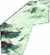
Static Map Catalogue - Full Metadata Record
Collection QuickBird-2
QuickBird-2. More details.
QB2_OPER_BGI_4B__MP_20080406T111403_N61-694_E006-920_0001
Download Product | BrowsePath | E006 |
Row | N61 |
Start Date | 2008-04-06T11:14:03.677Z |
Stop Date | 2008-04-06T11:14:03.677Z |
Availability Time | 2008-04-06T11:14:03.677Z |
Instrument Short Name | BGI |
Sensor Type | OPTICAL |
Sensor Mode | PM |
Orbit number | 0 |
Illumination Azimuth Angle | 173.8 |
Illumination Elevation Angle | 35.0 |
Footprint | 61.74092711 6.82551406 61.64553083 6.83221880 61.64831334 7.01560076 61.74372069 7.00946225 61.74092711 6.82551406 |
Scene Centre | 61.6946537536 6.92069978227 |
Size | 53390270 |
Acquisition Type | NOMINAL |
Product Type | BGI_4B__MP |
Cloud-Cover Percentage | 0 |
Resolution | 2.4 |
Processing Level | other: LV3A |
Bounding Box | 61.74372069 6.82551406 61.64553083 6.82551406 61.64553083 7.01560076 61.74372069 7.01560076 |
Scale | 1:50.000 Orthorectified |
Satellite | QuickBird-2 |
