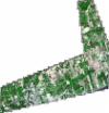
Static Map Catalogue - Full Metadata Record
Collection GeoEye-1
GeoEye-1. More details.
GE1_OPER_GIS_4B__MP_20190607T160720_N44-178_W077-539_0001
Download Product | Browsepath | W077 |
row | N44 |
Start Date | 2019-06-07T16:07:20.549Z |
Stop Date | 2019-06-07T16:07:20.549Z |
Availability Time | 2019-06-07T16:07:20.549Z |
Instrument Short Name | GIS |
Sensor Type | OPTICAL |
Sensor Mode | PM |
Orbit Number | 0 |
Illumination Azimuth Angle | 144.2 |
Illumination Elevation Angle | 65.3 |
Footprint | 44.26028078 -77.65623203 44.09135998 -77.64865463 44.09635060 -77.42399419 44.26530073 -77.43093048 44.26028078 -77.65623203 |
Scene Centre | 44.1783782711 -77.5399524092 |
Size | 429321454 |
Acquisition Type | NOMINAL |
Product Type | GIS_4B__MP |
Cloud-Cover Percentage | 0 |
Resolution | 1.2 |
Processing Level | other: LV3D |
Bounding Box | 44.26530073 -77.65623203 44.09135998 -77.65623203 44.09135998 -77.42399419 44.26530073 -77.42399419 |
Scale | 1:12.000 Orthorectified |
