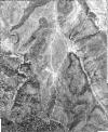
Static Map Catalogue - Full Metadata Record
Collection GeoEye-1
GeoEye-1. More details.
GE1_OPER_GIS_PAN_MP_20230817T110555_N40-953_W002-194_0001
Download Product | Browsepath | W002 |
row | N40 |
Start Date | 2023-08-17T11:05:55.563Z |
Stop Date | 2023-08-17T11:05:55.563Z |
Availability Time | 2023-08-17T11:05:55.563Z |
Instrument Short Name | GIS |
Sensor Type | OPTICAL |
Sensor Mode | PAN |
Orbit Number | 0 |
Illumination Azimuth Angle | 147.1 |
Illumination Elevation Angle | 59.0 |
Footprint | 40.97921661 -2.22224317 40.92827120 -2.22284086 40.92788538 -2.16756255 40.97883010 -2.16692236 40.97921661 -2.22224317 |
Scene Centre | 40.9535541255 -2.19489227354 |
Size | 351351591 |
Acquisition Type | NOMINAL |
Product Type | GIS_PAN_MP |
Cloud-Cover Percentage | 0 |
Resolution | 0.3 |
Processing Level | other: LV3D |
Bounding Box | 40.97921661 -2.22284086 40.92788538 -2.22284086 40.92788538 -2.16692236 40.97921661 -2.16692236 |
Scale | 1:12.000 Orthorectified |
