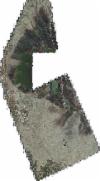
Static Map Catalogue - Full Metadata Record
Collection GeoEye-1
GeoEye-1. More details.
GE1_OPER_GIS_4B__2A_20200214T111204_N39-308_W000-336_0001
Download Product | Browsepath | W000 |
row | N39 |
Start Date | 2020-02-14T11:12:04.509Z |
Stop Date | 2020-02-14T11:12:04.509Z |
Availability Time | 2020-02-14T11:12:04.509Z |
Instrument Short Name | GIS |
Sensor Type | OPTICAL |
Sensor Mode | PM |
Orbit Number | 0 |
Illumination Azimuth Angle | 160.9 |
Illumination Elevation Angle | 35.7 |
Footprint | 39.41840477 -0.40976662 39.20162190 -0.41775188 39.19810343 -0.26371028 39.41485921 -0.25525009 39.41840477 -0.40976662 |
Scene Centre | 39.308272853 -0.336624138378 |
Size | 2705803599 |
Acquisition Type | NOMINAL |
Product Type | GIS_4B__2A |
Cloud-Cover Percentage | 0 |
Resolution | 0.5 |
Processing Level | other: LV2A |
Bounding Box | |
Scale |
