Static Map Catalogue - Full Metadata Record
Collection GeoEye-1
GeoEye-1. More details.
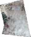
GE1_OPER_GIS_4B__MP_20210421T061429_N37-246_E067-422_0001
Download Product | Browsepath | E067 |
row | N37 |
Start Date | 2021-04-21T06:14:29.837Z |
Stop Date | 2021-04-21T06:14:29.837Z |
Availability Time | 2021-04-21T06:14:29.837Z |
Instrument Short Name | GIS |
Sensor Type | OPTICAL |
Sensor Mode | PM |
Orbit Number | 0 |
Illumination Azimuth Angle | 141.5 |
Illumination Elevation Angle | 59.8 |
Footprint | 37.26015286 67.40719427 37.23219848 67.40778265 37.23259214 67.43733022 37.26054691 67.43675274 37.26015286 67.40719427 |
Scene Centre | 37.2463735159 67.4222649854 |
Size | 174751905 |
Acquisition Type | NOMINAL |
Product Type | GIS_4B__MP |
Cloud-Cover Percentage | 0 |
Resolution | 0.4 |
Processing Level | other: LV3D |
Bounding Box | 37.26054691 67.40719427 37.23219848 67.40719427 37.23219848 67.43733022 37.26054691 67.43733022 |
Scale | 1:12.000 Orthorectified |
