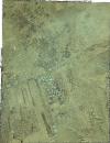
Static Map Catalogue - Full Metadata Record
Collection GeoEye-1
GeoEye-1. More details.
GE1_OPER_GIS_4B__MP_20211124T063310_N36-768_E067-322_0001
Download Product | Browsepath | E067 |
row | N36 |
Start Date | 2021-11-24T06:33:10.771Z |
Stop Date | 2021-11-24T06:33:10.771Z |
Availability Time | 2021-11-24T06:33:10.771Z |
Instrument Short Name | GIS |
Sensor Type | OPTICAL |
Sensor Mode | PM |
Orbit Number | 0 |
Illumination Azimuth Angle | 167.8 |
Illumination Elevation Angle | 31.9 |
Footprint | 36.79522462 67.29552279 36.74043183 67.29673545 36.74117137 67.34920113 36.79596562 67.34802578 36.79522462 67.29552279 |
Scene Centre | 36.7682012431 67.3223713741 |
Size | 827478199 |
Acquisition Type | NOMINAL |
Product Type | GIS_4B__MP |
Cloud-Cover Percentage | 0 |
Resolution | 0.4 |
Processing Level | other: LV3D |
Bounding Box | 36.79596562 67.29552279 36.74043183 67.29552279 36.74043183 67.34920113 36.79596562 67.34920113 |
Scale | 1:12.000 Orthorectified |
