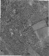
Static Map Catalogue - Full Metadata Record
Collection GeoEye-1
GeoEye-1. More details.
GE1_OPER_GIS_PAN_2A_20140717T080824_N48-019_E037-985_0001
Download Product | Browsepath | E037 |
row | N48 |
Start Date | 2014-07-17T08:08:24.382Z |
Stop Date | 2014-07-17T08:08:24.382Z |
Availability Time | 2014-07-17T08:08:24.382Z |
Instrument Short Name | GIS |
Sensor Type | OPTICAL |
Sensor Mode | PAN |
Orbit Number | 0 |
Illumination Azimuth Angle | 139.6 |
Illumination Elevation Angle | 58.3 |
Footprint | 48.04246565 37.95559174 47.99700607 37.95650962 47.99752478 38.01526090 48.04298518 38.01439467 48.04246565 37.95559174 |
Scene Centre | 48.0199991685 37.9854392812 |
Size | 89511273 |
Acquisition Type | NOMINAL |
Product Type | GIS_PAN_2A |
Cloud-Cover Percentage | 0 |
Resolution | 0.5 |
Processing Level | other: LV2A |
Bounding Box | |
Scale |
