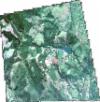
Static Map Catalogue - Full Metadata Record
Collection GeoEye-1
GeoEye-1. More details.
GE1_OPER_GIS_4B__MP_20120503T080306_S19-072_E032-838_0001
Download Product | Browsepath | E032 |
row | S19 |
Start Date | 2012-05-03T08:03:06.193Z |
Stop Date | 2012-05-03T08:03:06.193Z |
Availability Time | 2012-05-03T08:03:06.193Z |
Instrument Short Name | GIS |
Sensor Type | OPTICAL |
Sensor Mode | PM |
Orbit Number | 0 |
Illumination Azimuth Angle | 37.6 |
Illumination Elevation Angle | 47.1 |
Footprint | -19.04581094 32.81141634 -19.09862647 32.81135659 -19.09867423 32.86586844 -19.04585856 32.86591093 -19.04581094 32.81141634 |
Scene Centre | -19.0722445514 32.8386380752 |
Size | 30584358 |
Acquisition Type | NOMINAL |
Product Type | GIS_4B__MP |
Cloud-Cover Percentage | 0 |
Resolution | 2.0 |
Processing Level | other: LV3D |
Bounding Box | -19.04581094 32.81135659 -19.09867423 32.81135659 -19.09867423 32.86591093 -19.04581094 32.86591093 |
Scale | 1:12.000 Orthorectified |
