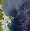
Static Map Catalogue - Full Metadata Record
Collection GeoEye-1
GeoEye-1. More details.
GE1_OPER_GIS_4B__2A_20190418T091104_N39-114_E026-571_0001
Download Product | Browsepath | E026 |
row | N39 |
Start Date | 2019-04-18T09:11:04.738Z |
Stop Date | 2019-04-18T09:11:04.738Z |
Availability Time | 2019-04-18T09:11:04.738Z |
Instrument Short Name | GIS |
Sensor Type | OPTICAL |
Sensor Mode | PM |
Orbit Number | 0 |
Illumination Azimuth Angle | 149.7 |
Illumination Elevation Angle | 58.6 |
Footprint | 39.13710756 26.54335906 39.09097178 26.54365673 39.09118001 26.60038460 39.13731612 26.60012393 39.13710756 26.54335906 |
Scene Centre | 39.1141473063 26.5718810837 |
Size | 27063732 |
Acquisition Type | NOMINAL |
Product Type | GIS_4B__2A |
Cloud-Cover Percentage | 0 |
Resolution | 2.0 |
Processing Level | other: LV2A |
Bounding Box | |
Scale |
