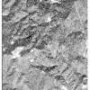
Static Map Catalogue - Full Metadata Record
Collection GeoEye-1
GeoEye-1. More details.
GE1_OPER_GIS_PAN_2A_20211104T092029_N41-615_E024-631_0001
Download Product | Browsepath | E024 |
row | N41 |
Start Date | 2021-11-04T09:20:29.502Z |
Stop Date | 2021-11-04T09:20:29.502Z |
Availability Time | 2021-11-04T09:20:29.502Z |
Instrument Short Name | GIS |
Sensor Type | OPTICAL |
Sensor Mode | PAN |
Orbit Number | 0 |
Illumination Azimuth Angle | 167.3 |
Illumination Elevation Angle | 32.2 |
Footprint | 41.63886787 24.60006421 41.59059078 24.60185415 41.59184549 24.66274708 41.64012469 24.66100248 41.63886787 24.60006421 |
Scene Centre | 41.6153612304 24.6314170142 |
Size | 138156087 |
Acquisition Type | NOMINAL |
Product Type | GIS_PAN_2A |
Cloud-Cover Percentage | 0 |
Resolution | 0.5 |
Processing Level | other: LV2A |
Bounding Box | |
Scale |
