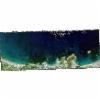
Static Map Catalogue - Full Metadata Record
Collection GeoEye-1
GeoEye-1. More details.
GE1_OPER_GIS_4B__2A_20210104T092031_N35-520_E023-972_0001
Download Product | Browsepath | E023 |
row | N35 |
Start Date | 2021-01-04T09:20:31.573Z |
Stop Date | 2021-01-04T09:20:31.573Z |
Availability Time | 2021-01-04T09:20:31.573Z |
Instrument Short Name | GIS |
Sensor Type | OPTICAL |
Sensor Mode | PM |
Orbit Number | 0 |
Illumination Azimuth Angle | 161.7 |
Illumination Elevation Angle | 29.8 |
Footprint | 35.53321852 23.93802458 35.51025633 23.93718715 35.50853636 24.00694099 35.53149710 24.00779824 35.53321852 23.93802458 |
Scene Centre | 35.5208820993 23.9724880533 |
Size | 10460194 |
Acquisition Type | NOMINAL |
Product Type | GIS_4B__2A |
Cloud-Cover Percentage | 0 |
Resolution | 2.0 |
Processing Level | other: LV2A |
Bounding Box | |
Scale |
