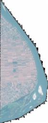
Static Map Catalogue - Full Metadata Record
Collection GeoEye-1
GeoEye-1. More details.
GE1_OPER_GIS_4B__2A_20190831T093512_N45-045_E020-340_0001
Download Product | Browsepath | E020 |
row | N45 |
Start Date | 2019-08-31T09:35:12.215Z |
Stop Date | 2019-08-31T09:35:12.215Z |
Availability Time | 2019-08-31T09:35:12.215Z |
Instrument Short Name | GIS |
Sensor Type | OPTICAL |
Sensor Mode | PM |
Orbit Number | 0 |
Illumination Azimuth Angle | 154.3 |
Illumination Elevation Angle | 51.3 |
Footprint | 45.09547181 20.31201518 44.99524877 20.31321550 44.99556846 20.36860781 45.09579260 20.36750429 45.09547181 20.31201518 |
Scene Centre | 45.0455237643 20.340336122 |
Size | 51996357 |
Acquisition Type | NOMINAL |
Product Type | GIS_4B__2A |
Cloud-Cover Percentage | 0 |
Resolution | 1.6 |
Processing Level | other: LV2A |
Bounding Box | |
Scale |
