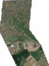
Static Map Catalogue - Full Metadata Record
Collection GeoEye-1
GeoEye-1. More details.
GE1_OPER_GIS_4B__MP_20110601T094548_N44-797_E020-021_0001
Download Product | Browsepath | E020 |
row | N44 |
Start Date | 2011-06-01T09:45:48.874Z |
Stop Date | 2011-06-01T09:45:48.874Z |
Availability Time | 2011-06-01T09:45:48.874Z |
Instrument Short Name | GIS |
Sensor Type | OPTICAL |
Sensor Mode | PM |
Orbit Number | 0 |
Illumination Azimuth Angle | 150.5 |
Illumination Elevation Angle | 65.0 |
Footprint | 44.84996316 19.96542616 44.74312028 19.96733371 44.74406439 20.07762757 44.85091077 20.07592368 44.84996316 19.96542616 |
Scene Centre | 44.7970279474 20.0215781635 |
Size | 107363225 |
Acquisition Type | NOMINAL |
Product Type | GIS_4B__MP |
Cloud-Cover Percentage | 0 |
Resolution | 1.6 |
Processing Level | other: LV3D |
Bounding Box | 44.85091077 19.96542616 44.74312028 19.96542616 44.74312028 20.07762757 44.85091077 20.07762757 |
Scale | 1:12.000 Orthorectified |
