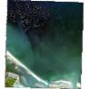
Static Map Catalogue - Full Metadata Record
Collection GeoEye-1
GeoEye-1. More details.
GE1_OPER_GIS_4B__2A_20200731T101436_N45-013_E012-481_0001
Download Product | Browsepath | E012 |
row | N45 |
Start Date | 2020-07-31T10:14:36.588Z |
Stop Date | 2020-07-31T10:14:36.588Z |
Availability Time | 2020-07-31T10:14:36.588Z |
Instrument Short Name | GIS |
Sensor Type | OPTICAL |
Sensor Mode | PM |
Orbit Number | 0 |
Illumination Azimuth Angle | 149.2 |
Illumination Elevation Angle | 60.3 |
Footprint | 45.03637415 12.45137890 44.98930841 12.45346690 44.99059028 12.51158210 45.03765812 12.50954162 45.03637415 12.45137890 |
Scene Centre | 45.0134864318 12.4814924785 |
Size | 19233603 |
Acquisition Type | NOMINAL |
Product Type | GIS_4B__2A |
Cloud-Cover Percentage | 0 |
Resolution | 1.6 |
Processing Level | other: LV2A |
Bounding Box | |
Scale |
