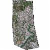
Static Map Catalogue - Full Metadata Record
Collection GeoEye-1
GeoEye-1. More details.
GE1_OPER_GIS_4B__2A_20210705T100544_N41-861_E012-453_0001
Download Product | Browsepath | E012 |
row | N41 |
Start Date | 2021-07-05T10:05:44.888Z |
Stop Date | 2021-07-05T10:05:44.888Z |
Availability Time | 2021-07-05T10:05:44.888Z |
Instrument Short Name | GIS |
Sensor Type | OPTICAL |
Sensor Mode | PM |
Orbit Number | 0 |
Illumination Azimuth Angle | 137.4 |
Illumination Elevation Angle | 66.2 |
Footprint | 41.89535941 12.42529298 41.82570935 12.42808729 41.82687633 12.48071186 41.89652923 12.47797457 41.89535941 12.42529298 |
Scene Centre | 41.8611215943 12.4530171876 |
Size | 54434894 |
Acquisition Type | NOMINAL |
Product Type | GIS_4B__2A |
Cloud-Cover Percentage | 0 |
Resolution | 1.6 |
Processing Level | other: LV2A |
Bounding Box | |
Scale |
