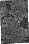
Static Map Catalogue - Full Metadata Record
Collection GeoEye-1
GeoEye-1. More details.
GE1_OPER_GIS_PAN_2A_20201107T103358_N49-576_E010-912_0001
Download Product | Browsepath | E010 |
row | N49 |
Start Date | 2020-11-07T10:33:58.272Z |
Stop Date | 2020-11-07T10:33:58.272Z |
Availability Time | 2020-11-07T10:33:58.272Z |
Instrument Short Name | GIS |
Sensor Type | OPTICAL |
Sensor Mode | PAN |
Orbit Number | 0 |
Illumination Azimuth Angle | 173.2 |
Illumination Elevation Angle | 23.9 |
Footprint | 49.59540563 10.89424084 49.55763769 10.89277909 49.55699528 10.93164408 49.59476236 10.93313581 49.59540563 10.89424084 |
Scene Centre | 49.5762018703 10.9129497973 |
Size | 78688533 |
Acquisition Type | NOMINAL |
Product Type | GIS_PAN_2A |
Cloud-Cover Percentage | 0 |
Resolution | 0.4 |
Processing Level | other: LV2A |
Bounding Box | |
Scale |
