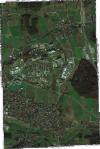
Static Map Catalogue - Full Metadata Record
Collection GeoEye-1
GeoEye-1. More details.
GE1_OPER_GIS_4B__2A_20201107T103358_N49-576_E010-912_0001
Download Product | Browsepath | E010 |
row | N49 |
Start Date | 2020-11-07T10:33:58.556Z |
Stop Date | 2020-11-07T10:33:58.556Z |
Availability Time | 2020-11-07T10:33:58.556Z |
Instrument Short Name | GIS |
Sensor Type | OPTICAL |
Sensor Mode | PM |
Orbit Number | 0 |
Illumination Azimuth Angle | 173.2 |
Illumination Elevation Angle | 23.9 |
Footprint | 49.59540010 10.89424893 49.55764295 10.89278759 49.55700081 10.93163601 49.59475711 10.93312730 49.59540010 10.89424893 |
Scene Centre | 49.5762018714 10.9129497999 |
Size | 19264392 |
Acquisition Type | NOMINAL |
Product Type | GIS_4B__2A |
Cloud-Cover Percentage | 0 |
Resolution | 1.6 |
Processing Level | other: LV2A |
Bounding Box | |
Scale |
