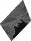
Static Map Catalogue - Full Metadata Record
Collection GeoEye-1
GeoEye-1. More details.
GE1_OPER_GIS_PAN_2A_20180919T103209_N44-345_E009-217_0001
Download Product | Browsepath | E009 |
row | N44 |
Start Date | 2018-09-19T10:32:09.627Z |
Stop Date | 2018-09-19T10:32:09.627Z |
Availability Time | 2018-09-19T10:32:09.627Z |
Instrument Short Name | GIS |
Sensor Type | OPTICAL |
Sensor Mode | PAN |
Orbit Number | 0 |
Illumination Azimuth Angle | 163.7 |
Illumination Elevation Angle | 46.1 |
Footprint | 44.38192813 9.17894306 44.30911703 9.17872169 44.30896913 9.25637597 44.38177987 9.25669351 44.38192813 9.17894306 |
Scene Centre | 44.3454551244 9.2176835229 |
Size | 120676544 |
Acquisition Type | NOMINAL |
Product Type | GIS_PAN_2A |
Cloud-Cover Percentage | 0 |
Resolution | 0.5 |
Processing Level | other: LV2A |
Bounding Box | |
Scale |
