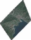
Static Map Catalogue - Full Metadata Record
Collection GeoEye-1
GeoEye-1. More details.
GE1_OPER_GIS_4B__2A_20180919T103209_N44-345_E009-217_0001
Download Product | Browsepath | E009 |
row | N44 |
Start Date | 2018-09-19T10:32:09.911Z |
Stop Date | 2018-09-19T10:32:09.911Z |
Availability Time | 2018-09-19T10:32:09.911Z |
Instrument Short Name | GIS |
Sensor Type | OPTICAL |
Sensor Mode | PM |
Orbit Number | 0 |
Illumination Azimuth Angle | 163.7 |
Illumination Elevation Angle | 46.1 |
Footprint | 44.38192137 9.17895245 44.30912376 9.17873112 44.30897591 9.25636659 44.38177314 9.25668407 44.38192137 9.17895245 |
Scene Centre | 44.3454551262 9.21768352291 |
Size | 30660316 |
Acquisition Type | NOMINAL |
Product Type | GIS_4B__2A |
Cloud-Cover Percentage | 0 |
Resolution | 2.0 |
Processing Level | other: LV2A |
Bounding Box | |
Scale |
