Static Map Catalogue - Full Metadata Record
Collection GEOSAT
GEOSAT ESA archive. More details here.
DE2_OPER_HRA_PSH_1C_20200403T083620_N44-647_E028-156_0000
Download Product | Browse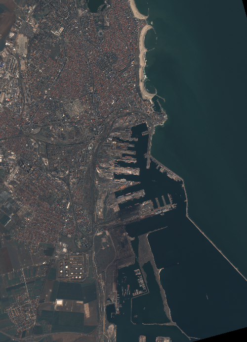
Start Date | 2020-04-03T08:36:20Z |
Stop Date | 2020-04-03T08:36:23Z |
Availability Time | 2020-04-03T08:36:23Z |
Instrument Short Name | HiRAIS |
Sensor Type | OPTICAL |
Operational mode | PSH |
Resolution | 0.75 |
Orbit | 31375 |
Satellite | GEOSAT-2 |
Product type | HRA_PSH_1C |
Orbit Direction | ASCENDING |
Scene Centre Longitude | E028 |
Scene Centre Latitude | N44 |
Illumination Azimuth Angle | 145.551518392 |
Illumination Elevation Angle | 46.3816 |
Footprint | 44.207852 28.598355 44.206395 28.699237 44.105970 28.696357 44.107421 28.595646 44.207852 28.598355 |
Product Size | 1017024666 |
Cloud Cover Percentage | 0 |
Acquisition Type | NOMINAL |
Bounding Box | 44.207852 28.595646 44.10597 28.595646 44.10597 28.699237 44.207852 28.699237 |
Original name | DE2_PSH_L1C_000000_20200403T083620_20200403T083623_DE2_31375_BEB3 |