Static Map Catalogue - Full Metadata Record
Collection GEOSAT
GEOSAT ESA archive. More details here.
DE2_OPER_HRA_PSH_1C_20200410T084953_N44-047_E026-495_0000
Download Product | Browse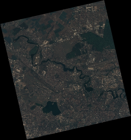
Start Date | 2020-04-10T08:49:53Z |
Stop Date | 2020-04-10T08:49:55Z |
Availability Time | 2020-04-10T08:49:55Z |
Instrument Short Name | HiRAIS |
Sensor Type | OPTICAL |
Operational mode | PSH |
Resolution | 0.75 |
Orbit | 31479 |
Satellite | GEOSAT-2 |
Product type | HRA_PSH_1C |
Orbit Direction | ASCENDING |
Scene Centre Longitude | E026 |
Scene Centre Latitude | N44 |
Illumination Azimuth Angle | 145.916261541 |
Illumination Elevation Angle | 49.0427 |
Footprint | 44.543523 25.949657 44.570061 26.103998 44.447152 26.145557 44.420613 25.991216 44.543523 25.949657 |
Product Size | 2134793111 |
Cloud Cover Percentage | 0 |
Acquisition Type | NOMINAL |
Bounding Box | 44.570061 25.949657 44.420613 25.949657 44.420613 26.145557 44.570061 26.145557 |
Original name | DE2_PSH_L1C_000000_20200410T084953_20200410T084955_DE2_31479_5D3B |