Static Map Catalogue - Full Metadata Record
Collection GEOSAT
GEOSAT ESA archive. More details here.
DE2_OPER_HRA_PSH_1C_20200410T084951_N44-085_E026-383_0000
Download Product | Browse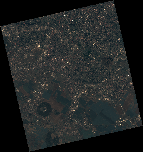
Start Date | 2020-04-10T08:49:51Z |
Stop Date | 2020-04-10T08:49:54Z |
Availability Time | 2020-04-10T08:49:54Z |
Instrument Short Name | HiRAIS |
Sensor Type | OPTICAL |
Operational mode | PSH |
Resolution | 0.75 |
Orbit | 31479 |
Satellite | GEOSAT-2 |
Product type | HRA_PSH_1C |
Orbit Direction | ASCENDING |
Scene Centre Longitude | E026 |
Scene Centre Latitude | N44 |
Illumination Azimuth Angle | 145.885633937 |
Illumination Elevation Angle | 49.147 |
Footprint | 44.432054 25.987497 44.458574 26.141475 44.335681 26.182955 44.309161 26.028977 44.432054 25.987497 |
Product Size | 2129254286 |
Cloud Cover Percentage | 0 |
Acquisition Type | NOMINAL |
Bounding Box | 44.458574 25.987497 44.309161 25.987497 44.309161 26.182955 44.458574 26.182955 |
Original name | DE2_PSH_L1C_000000_20200410T084951_20200410T084954_DE2_31479_1663 |