Static Map Catalogue - Full Metadata Record
Collection GEOSAT
GEOSAT ESA archive. More details here.
DE2_OPER_HRA_PSH_1C_20200410T084949_N44-122_E026-272_0000
Download Product | Browse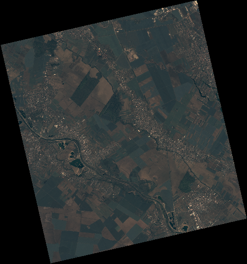
Start Date | 2020-04-10T08:49:49Z |
Stop Date | 2020-04-10T08:49:52Z |
Availability Time | 2020-04-10T08:49:52Z |
Instrument Short Name | HiRAIS |
Sensor Type | OPTICAL |
Operational mode | PSH |
Resolution | 0.75 |
Orbit | 31479 |
Satellite | GEOSAT-2 |
Product type | HRA_PSH_1C |
Orbit Direction | ASCENDING |
Scene Centre Longitude | E026 |
Scene Centre Latitude | N44 |
Illumination Azimuth Angle | 145.854306903 |
Illumination Elevation Angle | 49.2513 |
Footprint | 44.320560 26.025296 44.347058 26.179002 44.224006 26.220102 44.197507 26.066396 44.320560 26.025296 |
Product Size | 2096742697 |
Cloud Cover Percentage | 0 |
Acquisition Type | NOMINAL |
Bounding Box | 44.347058 26.025296 44.197507 26.025296 44.197507 26.220102 44.347058 26.220102 |
Original name | DE2_PSH_L1C_000000_20200410T084949_20200410T084952_DE2_31479_29F5 |