Static Map Catalogue - Full Metadata Record
Collection GEOSAT
GEOSAT ESA archive. More details here.
DE2_OPER_HRA_PSH_1C_20200329T085507_N46-618_E023-780_0000
Download Product | Browse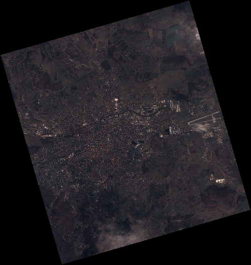
Start Date | 2020-03-29T08:55:07Z |
Stop Date | 2020-03-29T08:55:10Z |
Availability Time | 2020-03-29T08:55:10Z |
Instrument Short Name | HiRAIS |
Sensor Type | OPTICAL |
Operational mode | PSH |
Resolution | 0.75 |
Orbit | 31301 |
Satellite | GEOSAT-2 |
Product type | HRA_PSH_1C |
Orbit Direction | ASCENDING |
Scene Centre Longitude | E023 |
Scene Centre Latitude | N46 |
Illumination Azimuth Angle | 147.134292062 |
Illumination Elevation Angle | 42.1728 |
Footprint | 46.827578 23.515276 46.855579 23.675802 46.732960 23.721558 46.704958 23.561032 46.827578 23.515276 |
Product Size | 2089660914 |
Cloud Cover Percentage | 0 |
Acquisition Type | NOMINAL |
Bounding Box | 46.855579 23.515276 46.704958 23.515276 46.704958 23.721558 46.855579 23.721558 |
Original name | DE2_PSH_L1C_000000_20200329T085507_20200329T085510_DE2_31301_42D5 |