Static Map Catalogue - Full Metadata Record
Collection GEOSAT
GEOSAT ESA archive. More details here.
DE2_OPER_HRA_PSH_1C_20200312T091512_N37-616_E023-935_0000
Download Product | Browse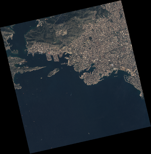
Start Date | 2020-03-12T09:15:12Z |
Stop Date | 2020-03-12T09:15:14Z |
Availability Time | 2020-03-12T09:15:14Z |
Instrument Short Name | HiRAIS |
Sensor Type | OPTICAL |
Operational mode | PSH |
Resolution | 0.75 |
Orbit | 31049 |
Satellite | GEOSAT-2 |
Product type | HRA_PSH_1C |
Orbit Direction | ASCENDING |
Scene Centre Longitude | E023 |
Scene Centre Latitude | N37 |
Illumination Azimuth Angle | 151.134927951 |
Illumination Elevation Angle | 44.9978 |
Footprint | 37.988047 23.520924 38.012507 23.677628 37.882263 23.712105 37.857803 23.555401 37.988047 23.520924 |
Product Size | 2319989366 |
Cloud Cover Percentage | 0 |
Acquisition Type | NOMINAL |
Bounding Box | 38.012507 23.520924 37.857803 23.520924 37.857803 23.712105 38.012507 23.712105 |
Original name | DE2_PSH_L1C_000000_20200312T091512_20200312T091514_DE2_31049_D357 |