Static Map Catalogue - Full Metadata Record
Collection GEOSAT
GEOSAT ESA archive. More details here.
DE2_OPER_HRA_PSH_1C_20200411T090509_N42-235_E023-678_0000
Download Product | Browse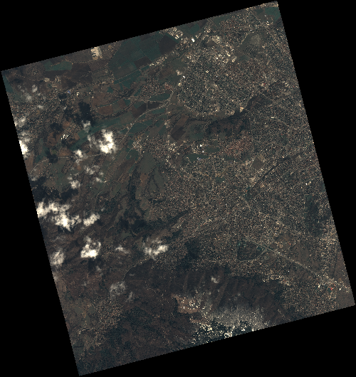
Start Date | 2020-04-11T09:05:09Z |
Stop Date | 2020-04-11T09:05:12Z |
Availability Time | 2020-04-11T09:05:12Z |
Instrument Short Name | HiRAIS |
Sensor Type | OPTICAL |
Operational mode | PSH |
Resolution | 0.75 |
Orbit | 31494 |
Satellite | GEOSAT-2 |
Product type | HRA_PSH_1C |
Orbit Direction | ASCENDING |
Scene Centre Longitude | E023 |
Scene Centre Latitude | N42 |
Illumination Azimuth Angle | 145.972817256 |
Illumination Elevation Angle | 51.3206 |
Footprint | 42.727646 23.140642 42.753228 23.291961 42.629740 23.329942 42.604158 23.178623 42.727646 23.140642 |
Product Size | 2191360782 |
Cloud Cover Percentage | 0 |
Acquisition Type | NOMINAL |
Bounding Box | 42.753228 23.140642 42.604158 23.140642 42.604158 23.329942 42.753228 23.329942 |
Original name | DE2_PSH_L1C_000000_20200411T090509_20200411T090512_DE2_31494_8BA1 |