Static Map Catalogue - Full Metadata Record
Collection GEOSAT
GEOSAT ESA archive. More details here.
DE2_OPER_HRA_PSH_1C_20200412T092226_N48-173_E017-093_0000
Download Product | Browse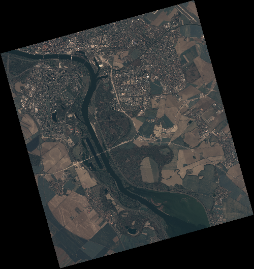
Start Date | 2020-04-12T09:22:26Z |
Stop Date | 2020-04-12T09:22:29Z |
Availability Time | 2020-04-12T09:22:29Z |
Instrument Short Name | HiRAIS |
Sensor Type | OPTICAL |
Operational mode | PSH |
Resolution | 0.75 |
Orbit | 31509 |
Satellite | GEOSAT-2 |
Product type | HRA_PSH_1C |
Orbit Direction | ASCENDING |
Scene Centre Longitude | E017 |
Scene Centre Latitude | N48 |
Illumination Azimuth Angle | 146.867118834 |
Illumination Elevation Angle | 46.4976 |
Footprint | 48.140780 17.068240 48.168017 17.233291 48.045292 17.278552 48.018056 17.113502 48.140780 17.068240 |
Product Size | 2137717390 |
Cloud Cover Percentage | 0 |
Acquisition Type | NOMINAL |
Bounding Box | 48.168017 17.06824 48.018056 17.06824 48.018056 17.278552 48.168017 17.278552 |
Original name | DE2_PSH_L1C_000000_20200412T092226_20200412T092229_DE2_31509_D22E |