Static Map Catalogue - Full Metadata Record
Collection GEOSAT
GEOSAT ESA archive. More details here.
DE2_OPER_HRA_PSH_1C_20200312T091807_N48-137_E017-233_0000
Download Product | Browse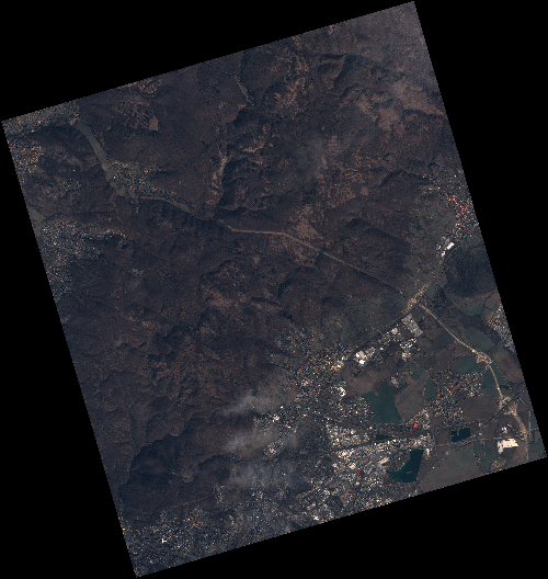
Start Date | 2020-03-12T09:18:07Z |
Stop Date | 2020-03-12T09:18:10Z |
Availability Time | 2020-03-12T09:18:10Z |
Instrument Short Name | HiRAIS |
Sensor Type | OPTICAL |
Operational mode | PSH |
Resolution | 0.75 |
Orbit | 31049 |
Satellite | GEOSAT-2 |
Product type | HRA_PSH_1C |
Orbit Direction | ASCENDING |
Scene Centre Longitude | E017 |
Scene Centre Latitude | N48 |
Illumination Azimuth Angle | 148.466311959 |
Illumination Elevation Angle | 33.9931 |
Footprint | 48.279991 17.030645 48.309183 17.196414 48.186194 17.244937 48.157003 17.079168 48.279991 17.030645 |
Product Size | 2095690353 |
Cloud Cover Percentage | 0 |
Acquisition Type | NOMINAL |
Bounding Box | 48.309183 17.030645 48.157003 17.030645 48.157003 17.244937 48.309183 17.244937 |
Original name | DE2_PSH_L1C_000000_20200312T091807_20200312T091810_DE2_31049_9EE3 |