Static Map Catalogue - Full Metadata Record
Collection GEOSAT
GEOSAT ESA archive. More details here.
DE2_OPER_HRA_PSH_1C_20200312T091805_N48-181_E017-121_0000
Download Product | Browse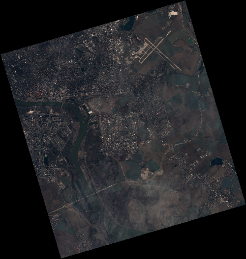
Start Date | 2020-03-12T09:18:05Z |
Stop Date | 2020-03-12T09:18:08Z |
Availability Time | 2020-03-12T09:18:08Z |
Instrument Short Name | HiRAIS |
Sensor Type | OPTICAL |
Operational mode | PSH |
Resolution | 0.75 |
Orbit | 31049 |
Satellite | GEOSAT-2 |
Product type | HRA_PSH_1C |
Orbit Direction | ASCENDING |
Scene Centre Longitude | E017 |
Scene Centre Latitude | N48 |
Illumination Azimuth Angle | 148.467505129 |
Illumination Elevation Angle | 34.1008 |
Footprint | 48.168470 17.074758 48.197565 17.240194 48.074658 17.288886 48.045563 17.123450 48.168470 17.074758 |
Product Size | 2108482772 |
Cloud Cover Percentage | 0 |
Acquisition Type | NOMINAL |
Bounding Box | 48.197565 17.074758 48.045563 17.074758 48.045563 17.288886 48.197565 17.288886 |
Original name | DE2_PSH_L1C_000000_20200312T091805_20200312T091808_DE2_31049_B91C |