Static Map Catalogue - Full Metadata Record
Collection GEOSAT
GEOSAT ESA archive. More details here.
DE2_OPER_HRA_PSH_1C_20200406T092448_N48-340_E016-263_0000
Download Product | Browse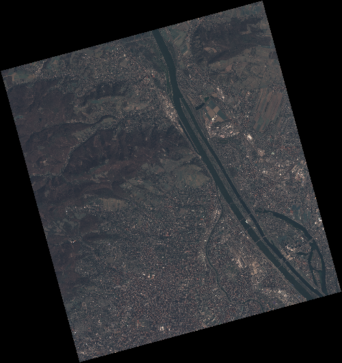
Start Date | 2020-04-06T09:24:48Z |
Stop Date | 2020-04-06T09:24:50Z |
Availability Time | 2020-04-06T09:24:50Z |
Instrument Short Name | HiRAIS |
Sensor Type | OPTICAL |
Operational mode | PSH |
Resolution | 0.75 |
Orbit | 31420 |
Satellite | GEOSAT-2 |
Product type | HRA_PSH_1C |
Orbit Direction | ASCENDING |
Scene Centre Longitude | E016 |
Scene Centre Latitude | N48 |
Illumination Azimuth Angle | 147.26733743 |
Illumination Elevation Angle | 44.0529 |
Footprint | 48.311044 16.234357 48.338646 16.399560 48.216041 16.445900 48.188439 16.280697 48.311044 16.234357 |
Product Size | 2134488927 |
Cloud Cover Percentage | 0 |
Acquisition Type | NOMINAL |
Bounding Box | 48.338646 16.234357 48.188439 16.234357 48.188439 16.4459 48.338646 16.4459 |
Original name | DE2_PSH_L1C_000000_20200406T092448_20200406T092450_DE2_31420_9594 |