Static Map Catalogue - Full Metadata Record
Collection GEOSAT
GEOSAT ESA archive. More details here.
DE2_OPER_HRA_PSH_1C_20200319T093020_N43-455_E016-527_0000
Download Product | Browse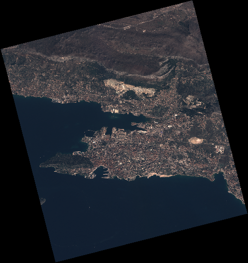
Start Date | 2020-03-19T09:30:20Z |
Stop Date | 2020-03-19T09:30:23Z |
Availability Time | 2020-03-19T09:30:23Z |
Instrument Short Name | HiRAIS |
Sensor Type | OPTICAL |
Operational mode | PSH |
Resolution | 0.75 |
Orbit | 31153 |
Satellite | GEOSAT-2 |
Product type | HRA_PSH_1C |
Orbit Direction | ASCENDING |
Scene Centre Longitude | E016 |
Scene Centre Latitude | N43 |
Illumination Azimuth Angle | 148.672355126 |
Illumination Elevation Angle | 41.6287 |
Footprint | 43.575904 16.358958 43.601994 16.510839 43.478978 16.551336 43.452888 16.399456 43.575904 16.358958 |
Product Size | 1990635360 |
Cloud Cover Percentage | 0 |
Acquisition Type | NOMINAL |
Bounding Box | 43.601994 16.358958 43.452888 16.358958 43.452888 16.551336 43.601994 16.551336 |
Original name | DE2_PSH_L1C_000000_20200319T093020_20200319T093023_DE2_31153_126A |