Static Map Catalogue - Full Metadata Record
Collection GEOSAT
GEOSAT ESA archive. More details here.
DE2_OPER_HRA_PSH_1B_20170322T091920_N37-018_E015-737_0000
Download Product | Browse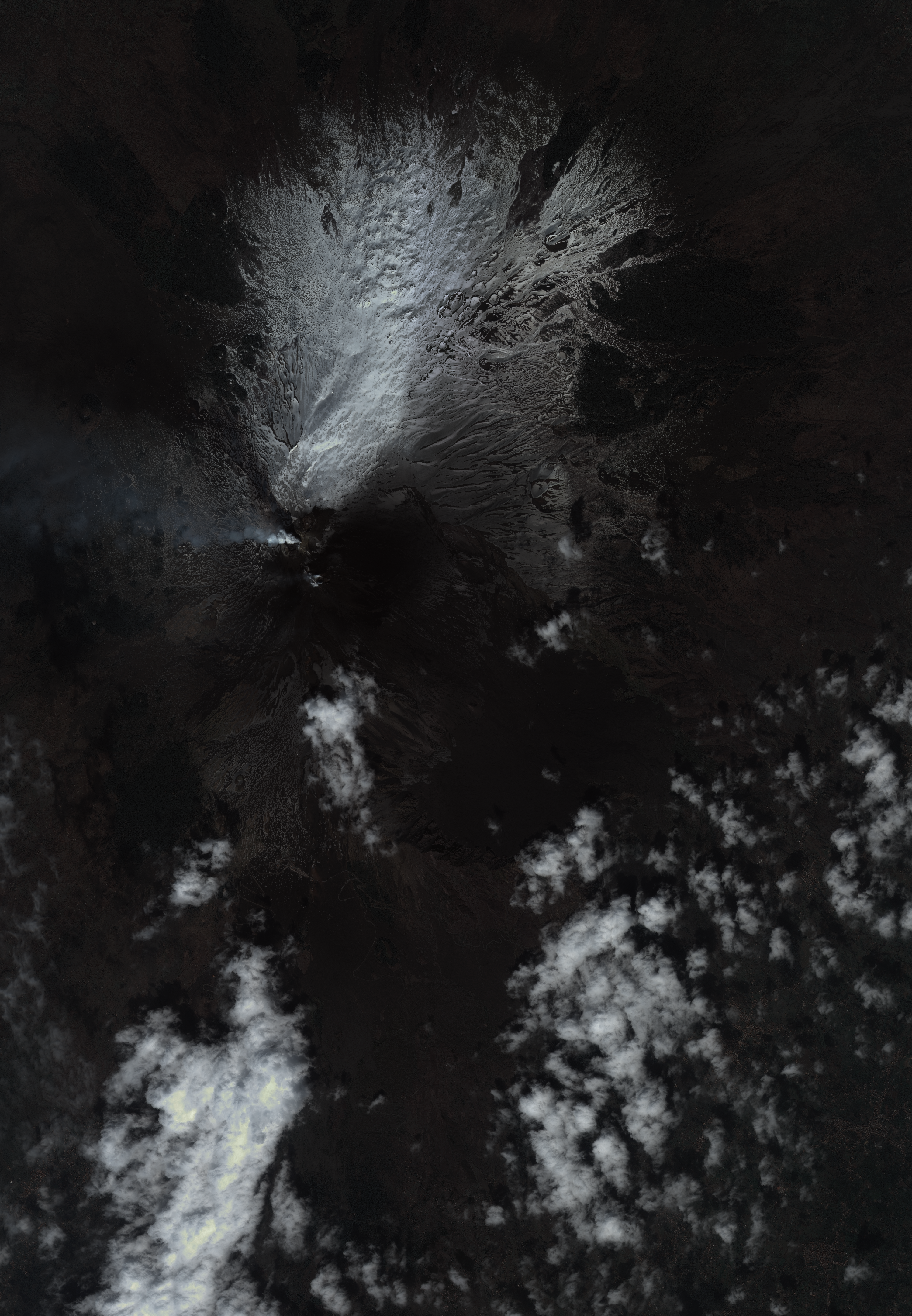
Start Date | 2017-03-22T09:19:20Z |
Stop Date | 2017-03-22T09:19:25Z |
Availability Time | 2017-03-22T09:19:25Z |
Instrument Short Name | HiRAIS |
Sensor Type | OPTICAL |
Operational mode | PSH |
Resolution | 1.0 |
Orbit | 14935 |
Satellite | GEOSAT-2 |
Product type | HRA_PSH_1B |
Orbit Direction | ASCENDING |
Scene Centre Longitude | E015 |
Scene Centre Latitude | N37 |
Illumination Azimuth Angle | 139.853484165 |
Illumination Elevation Angle | 45.5662 |
Footprint | 37.813975 14.872557 37.861267 15.095403 37.661518 15.162434 37.614792 14.942435 37.813975 14.872557 |
Product Size | 1427140510 |
Cloud Cover Percentage | 0 |
Acquisition Type | NOMINAL |
Bounding Box | |
Original name | DE2_PSH_L1B_000000_20170322T091920_20170322T091925_DE2_14935_DE02 |