Static Map Catalogue - Full Metadata Record
Collection GEOSAT
GEOSAT ESA archive. More details here.
DE2_OPER_HRA_PSH_1C_20200319T093105_N46-430_E014-065_0000
Download Product | Browse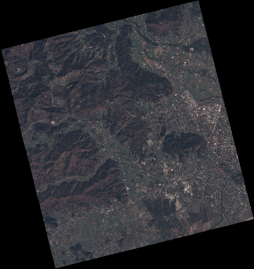
Start Date | 2020-03-19T09:31:05Z |
Stop Date | 2020-03-19T09:31:07Z |
Availability Time | 2020-03-19T09:31:07Z |
Instrument Short Name | HiRAIS |
Sensor Type | OPTICAL |
Operational mode | PSH |
Resolution | 0.75 |
Orbit | 31153 |
Satellite | GEOSAT-2 |
Product type | HRA_PSH_1C |
Orbit Direction | ASCENDING |
Scene Centre Longitude | E014 |
Scene Centre Latitude | N46 |
Illumination Azimuth Angle | 147.572505915 |
Illumination Elevation Angle | 38.784 |
Footprint | 46.113269 14.328152 46.141850 14.487821 46.018697 14.533689 45.990116 14.374020 46.113269 14.328152 |
Product Size | 2174327456 |
Cloud Cover Percentage | 0 |
Acquisition Type | NOMINAL |
Bounding Box | 46.14185 14.328152 45.990116 14.328152 45.990116 14.533689 46.14185 14.533689 |
Original name | DE2_PSH_L1C_000000_20200319T093105_20200319T093107_DE2_31153_0FE0 |