Static Map Catalogue - Full Metadata Record
Collection GEOSAT
GEOSAT ESA archive. More details here.
DE2_OPER_HRA_PM4_1C_20210128T093846_N44-045_E012-529_0001
Download Product | Browse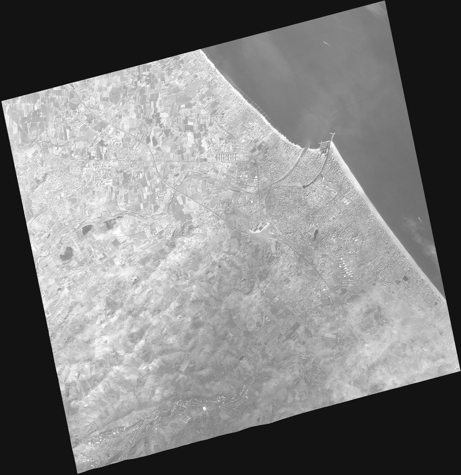
Start Date | 2021-01-28T09:38:46Z |
Stop Date | 2021-01-28T09:38:52Z |
Availability Time | 2021-01-28T09:38:52Z |
Instrument Short Name | HiRAIS |
Sensor Type | OPTICAL |
Operational mode | PM4 |
Resolution | |
Orbit | 35827 |
Satellite | GEOSAT-2 |
Product type | HRA_PM4_1C |
Orbit Direction | ASCENDING |
Scene Centre Longitude | |
Scene Centre Latitude | |
Illumination Azimuth Angle | 152.972584605 |
Illumination Elevation Angle | 23.502300000000005 |
Footprint | 44.002991 12.638671 44.12674 12.598039 44.089047 12.420256 43.964637 12.461154 44.002991 12.638671 |
Product Size | 414548632 |
Cloud Cover Percentage | 0 |
Acquisition Type | NOMINAL |
Bounding Box | 44.12674 12.420256 43.964637 12.420256 43.964637 12.638671 44.12674 12.638671 44.12674 12.420256 |
Original name | DE2_PM4_L1C_000000_20210128T093846_20210128T093852_DE2_35827_DE02.zip |