Static Map Catalogue - Full Metadata Record
Collection GEOSAT
GEOSAT ESA archive. More details here.
DE2_OPER_HRA_PSH_1C_20200407T094037_N48-789_E011-281_0000
Download Product | Browse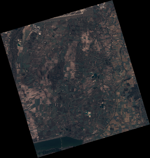
Start Date | 2020-04-07T09:40:37Z |
Stop Date | 2020-04-07T09:40:40Z |
Availability Time | 2020-04-07T09:40:40Z |
Instrument Short Name | HiRAIS |
Sensor Type | OPTICAL |
Operational mode | PSH |
Resolution | 0.75 |
Orbit | 31435 |
Satellite | GEOSAT-2 |
Product type | HRA_PSH_1C |
Orbit Direction | ASCENDING |
Scene Centre Longitude | E011 |
Scene Centre Latitude | N48 |
Illumination Azimuth Angle | 146.406461314 |
Illumination Elevation Angle | 44.2002 |
Footprint | 48.328232 11.683340 48.356682 11.848460 48.234255 11.896334 48.205806 11.731214 48.328232 11.683340 |
Product Size | 2123390886 |
Cloud Cover Percentage | 0 |
Acquisition Type | NOMINAL |
Bounding Box | 48.356682 11.68334 48.205806 11.68334 48.205806 11.896334 48.356682 11.896334 |
Original name | DE2_PSH_L1C_000000_20200407T094037_20200407T094040_DE2_31435_C762 |