Static Map Catalogue - Full Metadata Record
Collection GEOSAT
GEOSAT ESA archive. More details here.
DE2_OPER_HRA_PM4_1C_20200407T093855_N41-247_E012-841_0000
Download Product | Browse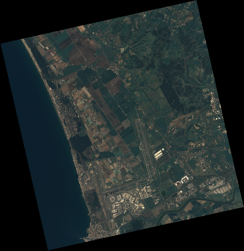
Start Date | 2020-04-07T09:38:55Z |
Stop Date | 2020-04-07T09:38:58Z |
Availability Time | 2020-04-07T09:38:58Z |
Instrument Short Name | HiRAIS |
Sensor Type | OPTICAL |
Operational mode | PM4 |
Resolution | 3.0 |
Orbit | 31435 |
Satellite | GEOSAT-2 |
Product type | HRA_PM4_1C |
Orbit Direction | ASCENDING |
Scene Centre Longitude | E012 |
Scene Centre Latitude | N41 |
Illumination Azimuth Angle | 142.450368646 |
Illumination Elevation Angle | 49.4528 |
Footprint | 41.890214 12.145547 41.920931 12.305920 41.793766 12.350453 41.763048 12.190079 41.890214 12.145547 |
Product Size | 728577266 |
Cloud Cover Percentage | 0 |
Acquisition Type | NOMINAL |
Bounding Box | 41.920931 12.145547 41.763048 12.145547 41.763048 12.350453 41.920931 12.350453 |
Original name | DE2_PM4_L1C_000000_20200407T093855_20200407T093858_DE2_31435_7DEF |