Static Map Catalogue - Full Metadata Record
Collection GEOSAT
GEOSAT ESA archive. More details here.
DE2_OPER_HRA_PSH_1C_20200408T095531_N45-692_E009-125_0000
Download Product | Browse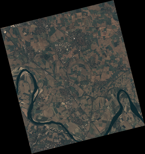
Start Date | 2020-04-08T09:55:31Z |
Stop Date | 2020-04-08T09:55:34Z |
Availability Time | 2020-04-08T09:55:34Z |
Instrument Short Name | HiRAIS |
Sensor Type | OPTICAL |
Operational mode | PSH |
Resolution | 0.75 |
Orbit | 31450 |
Satellite | GEOSAT-2 |
Product type | HRA_PSH_1C |
Orbit Direction | ASCENDING |
Scene Centre Longitude | E009 |
Scene Centre Latitude | N45 |
Illumination Azimuth Angle | 146.639017459 |
Illumination Elevation Angle | 47.8243 |
Footprint | 45.173604 9.593786 45.200087 9.750016 45.077069 9.791531 45.050586 9.635301 45.173604 9.593786 |
Product Size | 2169878107 |
Cloud Cover Percentage | 0 |
Acquisition Type | NOMINAL |
Bounding Box | 45.200087 9.593786 45.050586 9.593786 45.050586 9.791531 45.200087 9.791531 |
Original name | DE2_PSH_L1C_000000_20200408T095531_20200408T095534_DE2_31450_59E7 |