Static Map Catalogue - Full Metadata Record
Collection GEOSAT
GEOSAT ESA archive. More details here.
DE2_OPER_HRA_PSH_1C_20200321T100224_N45-239_E009-412_0000
Download Product | Browse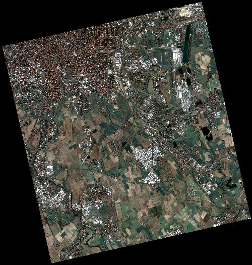
Start Date | 2020-03-21T10:02:24Z |
Stop Date | 2020-03-21T10:02:27Z |
Availability Time | 2020-03-21T10:02:27Z |
Instrument Short Name | HiRAIS |
Sensor Type | OPTICAL |
Operational mode | PSH |
Resolution | 0.75 |
Orbit | 31183 |
Satellite | GEOSAT-2 |
Product type | HRA_PSH_1C |
Orbit Direction | ASCENDING |
Scene Centre Longitude | E009 |
Scene Centre Latitude | N45 |
Illumination Azimuth Angle | 150.310900046 |
Illumination Elevation Angle | 41.0962 |
Footprint | 45.462617 9.137132 45.488295 9.301619 45.362560 9.341749 45.336882 9.177263 45.462617 9.137132 |
Product Size | 2261592859 |
Cloud Cover Percentage | 0 |
Acquisition Type | NOMINAL |
Bounding Box | 45.488295 9.137132 45.336882 9.137132 45.336882 9.341749 45.488295 9.341749 |
Original name | DE2_PSH_L1C_000000_20200321T100224_20200321T100227_DE2_31183_7B30 |