Static Map Catalogue - Full Metadata Record
Collection GEOSAT
GEOSAT ESA archive. More details here.
DE2_OPER_HRA_PM4_1C_20200409T101226_N48-540_E002-961_0000
Download Product | Browse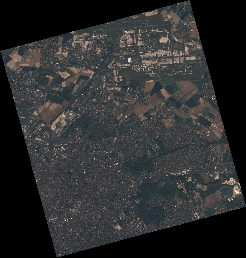
Start Date | 2020-04-09T10:12:26Z |
Stop Date | 2020-04-09T10:12:28Z |
Availability Time | 2020-04-09T10:12:28Z |
Instrument Short Name | HiRAIS |
Sensor Type | OPTICAL |
Operational mode | PM4 |
Resolution | 3.0 |
Orbit | 31465 |
Satellite | GEOSAT-2 |
Product type | HRA_PM4_1C |
Orbit Direction | ASCENDING |
Scene Centre Longitude | E002 |
Scene Centre Latitude | N48 |
Illumination Azimuth Angle | 144.904187742 |
Illumination Elevation Angle | 43.9044 |
Footprint | 49.007763 2.428300 49.038825 2.600115 48.914986 2.652092 48.883924 2.480277 49.007763 2.428300 |
Product Size | 696157472 |
Cloud Cover Percentage | 0 |
Acquisition Type | NOMINAL |
Bounding Box | 49.038825 2.4283 48.883924 2.4283 48.883924 2.652092 49.038825 2.652092 |
Original name | DE2_PM4_L1C_000000_20200409T101226_20200409T101228_DE2_31465_6C9E |