Static Map Catalogue - Full Metadata Record
Collection GEOSAT
GEOSAT ESA archive. More details here.
DE2_OPER_HRA_PSH_1C_20190315T102435_N41-170_E002-360_0000
Download Product | Browse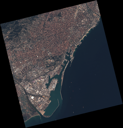
Start Date | 2019-03-15T10:24:35Z |
Stop Date | 2019-03-15T10:24:38Z |
Availability Time | 2019-03-15T10:24:38Z |
Instrument Short Name | HiRAIS |
Sensor Type | OPTICAL |
Operational mode | PSH |
Resolution | 0.75 |
Orbit | 25664 |
Satellite | GEOSAT-2 |
Product type | HRA_PSH_1C |
Orbit Direction | ASCENDING |
Scene Centre Longitude | E002 |
Scene Centre Latitude | N41 |
Illumination Azimuth Angle | 147.323342324 |
Illumination Elevation Angle | 41.3333 |
Footprint | 41.409034 2.070149 41.439436 2.227814 41.312620 2.271152 41.282219 2.113487 41.409034 2.070149 |
Product Size | 2266856294 |
Cloud Cover Percentage | 0 |
Acquisition Type | NOMINAL |
Bounding Box | 41.439436 2.070149 41.282219 2.070149 41.282219 2.271152 41.439436 2.271152 |
Original name | DE2_PSH_L1C_000000_20190315T102435_20190315T102438_DE2_25664_50F2 |