Static Map Catalogue - Full Metadata Record
Collection GEOSAT
GEOSAT ESA archive. More details here.
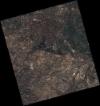
DE2_OPER_HRA_PSH_1C_20200311T103733_N41-883_W000-610_0000
Download Product | BrowseStart Date | 2020-03-11T10:37:33Z |
Stop Date | 2020-03-11T10:37:36Z |
Availability Time | 2020-03-11T10:37:36Z |
Instrument Short Name | HiRAIS |
Sensor Type | OPTICAL |
Operational mode | PSH |
Resolution | 0.75 |
Orbit | 31035 |
Satellite | GEOSAT-2 |
Product type | HRA_PSH_1C |
Orbit Direction | ASCENDING |
Scene Centre Longitude | W000 |
Scene Centre Latitude | N41 |
Illumination Azimuth Angle | 148.075302338 |
Illumination Elevation Angle | 39.9424 |
Footprint | 41.658073 -0.977524 41.685213 -0.829221 41.562082 -0.788620 41.534942 -0.936923 41.658073 -0.977524 |
Product Size | 2251007455 |
Cloud Cover Percentage | 0 |
Acquisition Type | NOMINAL |
Bounding Box | 41.685213 -0.977524 41.534942 -0.977524 41.534942 -0.78862 41.685213 -0.78862 |
Original name | DE2_PSH_L1C_000000_20200311T103733_20200311T103736_DE2_31035_91C8 |
