Static Map Catalogue - Full Metadata Record
Collection GEOSAT
GEOSAT ESA archive. More details here.
DE2_OPER_HRA_PSH_1C_20200105T110108_N40-625_W003-534_0000
Download Product | Browse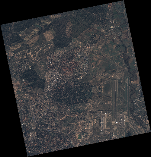
Start Date | 2020-01-05T11:01:08Z |
Stop Date | 2020-01-05T11:01:11Z |
Availability Time | 2020-01-05T11:01:11Z |
Instrument Short Name | HiRAIS |
Sensor Type | OPTICAL |
Operational mode | PSH |
Resolution | 0.75 |
Orbit | 30056 |
Satellite | GEOSAT-2 |
Product type | HRA_PSH_1C |
Orbit Direction | ASCENDING |
Scene Centre Longitude | W003 |
Scene Centre Latitude | N40 |
Illumination Azimuth Angle | 160.136900685 |
Illumination Elevation Angle | 24.2324 |
Footprint | 40.585734 -3.721853 40.610517 -3.565262 40.482805 -3.529577 40.458022 -3.686167 40.585734 -3.721853 |
Product Size | 2335400348 |
Cloud Cover Percentage | 0 |
Acquisition Type | NOMINAL |
Bounding Box | 40.610517 -3.721853 40.458022 -3.721853 40.458022 -3.529577 40.610517 -3.529577 |
Original name | DE2_PSH_L1C_000000_20200105T110108_20200105T110111_DE2_30056_6E71 |