Static Map Catalogue - Full Metadata Record
Collection GEOSAT
GEOSAT ESA archive. More details here.
DE2_OPER_HRA_PSH_1C_20200105T110107_N40-593_W003-418_0000
Download Product | Browse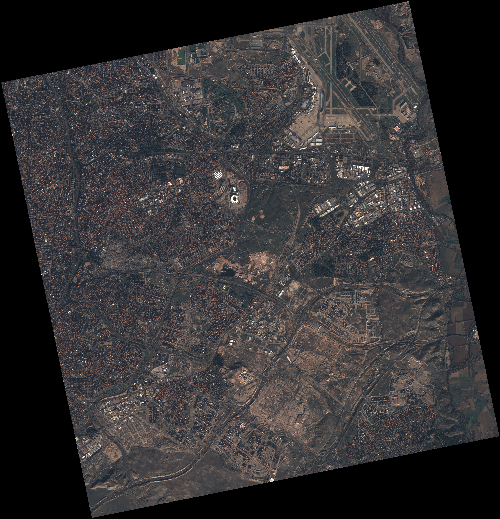
Start Date | 2020-01-05T11:01:07Z |
Stop Date | 2020-01-05T11:01:09Z |
Availability Time | 2020-01-05T11:01:09Z |
Instrument Short Name | HiRAIS |
Sensor Type | OPTICAL |
Operational mode | PSH |
Resolution | 0.75 |
Orbit | 30056 |
Satellite | GEOSAT-2 |
Product type | HRA_PSH_1C |
Orbit Direction | ASCENDING |
Scene Centre Longitude | W003 |
Scene Centre Latitude | N40 |
Illumination Azimuth Angle | 160.142832412 |
Illumination Elevation Angle | 24.347300000000004 |
Footprint | 40.469885 -3.689292 40.494617 -3.533094 40.366983 -3.497536 40.342251 -3.653735 40.469885 -3.689292 |
Product Size | 2340911686 |
Cloud Cover Percentage | 0 |
Acquisition Type | NOMINAL |
Bounding Box | 40.494617 -3.689292 40.342251 -3.689292 40.342251 -3.497536 40.494617 -3.497536 |
Original name | DE2_PSH_L1C_000000_20200105T110107_20200105T110109_DE2_30056_6277 |