ESA TPM Map Catalogue - Product List
back to previous node |
list of download URLs


Collection G2_Portugal_2021
GEOSAT-2 Portugal Coverage 2021 collection. More details here.
List of available products (latitude from 41.9039 to 41.9788 dg, longitude from -8.68812 to -8.54375 dg)..
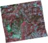
DE2_OPER_HRA_PSH_1C_20211104T111623_N41-855_W008-660_0001
Download Product | Product Info | Browse
Platform Short Name | GEOSAT |
Platform Serial Identifier | 2 |
Product Type | HRA_PSH_1C |
Start Date | 2021-11-04T11:16:23Z |
Stop Date | 2021-11-04T11:16:26Z |
Original Name | DE2_PSH_L1C_000000_20211104T111623_20211104T111626_DE2_39983_0C9D.zip |
Footprint | 41.7925648574 -8.52365409489 41.9455213828 -8.56273689697 41.9191339157 -8.79317413345 41.7654515529 -8.76083383064 41.7925648574 -8.52365409489 |
Orbit Direction | ASCENDING |
Scene Centre Longitude | W008 |
Scene Centre Latitude | N41 |
Cloud Cover Percentage | -1 |
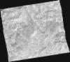
DE2_OPER_HRA_PM4_1C_20211104T111623_N41-855_W008-660_0001
Download Product | Product Info | Browse
Platform Short Name | GEOSAT |
Platform Serial Identifier | 2 |
Product Type | HRA_PM4_1C |
Start Date | 2021-11-04T11:16:23Z |
Stop Date | 2021-11-04T11:16:26Z |
Original Name | DE2_PM4_L1C_000000_20211104T111623_20211104T111626_DE2_39983_0C9D.zip |
Footprint | 41.7925648574 -8.52365409489 41.9455213828 -8.56273689697 41.9191339157 -8.79317413345 41.7654515529 -8.76083383064 41.7925648574 -8.52365409489 |
Orbit Direction | ASCENDING |
Scene Centre Longitude | W008 |
Scene Centre Latitude | N41 |
Cloud Cover Percentage | -1 |
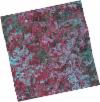
DE2_OPER_HRA_PSH_1C_20210708T110909_N41-925_W008-485_0001
Download Product | Product Info | Browse
Platform Short Name | GEOSAT |
Platform Serial Identifier | 2 |
Product Type | HRA_PSH_1C |
Start Date | 2021-07-08T11:09:09Z |
Stop Date | 2021-07-08T11:09:12Z |
Original Name | DE2_PSH_L1C_000000_20210708T110909_20210708T110912_DE2_38217_4FEB.zip |
Footprint | 41.8720547526 -8.38221749576 42.0030841252 -8.4201568352 41.9783406642 -8.58737184567 41.8469766132 -8.55187165197 41.8720547526 -8.38221749576 |
Orbit Direction | ASCENDING |
Scene Centre Longitude | W008 |
Scene Centre Latitude | N41 |
Cloud Cover Percentage | -1 |
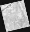
DE2_OPER_HRA_PM4_1C_20210708T110909_N41-925_W008-485_0001
Download Product | Product Info | Browse
Platform Short Name | GEOSAT |
Platform Serial Identifier | 2 |
Product Type | HRA_PM4_1C |
Start Date | 2021-07-08T11:09:09Z |
Stop Date | 2021-07-08T11:09:12Z |
Original Name | DE2_PM4_L1C_000000_20210708T110909_20210708T110912_DE2_38217_4FEB.zip |
Footprint | 41.8720547526 -8.38221749576 42.0030841252 -8.4201568352 41.9783406642 -8.58737184567 41.8469766132 -8.55187165197 41.8720547526 -8.38221749576 |
Orbit Direction | ASCENDING |
Scene Centre Longitude | W008 |
Scene Centre Latitude | N41 |
Cloud Cover Percentage | -1 |
DE2_OPER_HRA_PSH_1C_20210525T110211_N41-882_W008-726_0001
Download Product | Product Info | Browse
Platform Short Name | GEOSAT |
Platform Serial Identifier | 2 |
Product Type | HRA_PSH_1C |
Start Date | 2021-05-25T11:02:11Z |
Stop Date | 2021-05-25T11:02:14Z |
Original Name | DE2_PSH_L1C_000000_20210525T110211_20210525T110214_DE2_37564_E5E0.zip |
Footprint | 41.8339324981 -8.63385193874 41.9568217235 -8.67192822698 41.9311758526 -8.81982181315 41.8083545386 -8.78138683847 41.8339324981 -8.63385193874 |
Orbit Direction | ASCENDING |
Scene Centre Longitude | W008 |
Scene Centre Latitude | N41 |
Cloud Cover Percentage | -1 |
DE2_OPER_HRA_PM4_1C_20210525T110211_N41-882_W008-726_0001
Download Product | Product Info | Browse
Platform Short Name | GEOSAT |
Platform Serial Identifier | 2 |
Product Type | HRA_PM4_1C |
Start Date | 2021-05-25T11:02:11Z |
Stop Date | 2021-05-25T11:02:14Z |
Original Name | DE2_PM4_L1C_000000_20210525T110211_20210525T110214_DE2_37564_E5E0.zip |
Footprint | 41.8339324981 -8.63385193874 41.9568217235 -8.67192822698 41.9311758526 -8.81982181315 41.8083545386 -8.78138683847 41.8339324981 -8.63385193874 |
Orbit Direction | ASCENDING |
Scene Centre Longitude | W008 |
Scene Centre Latitude | N41 |
Cloud Cover Percentage | -1 |
DE2_OPER_HRA_PSH_1C_20210318T110701_N41-914_W008-563_0001
Download Product | Product Info | Browse
Platform Short Name | GEOSAT |
Platform Serial Identifier | 2 |
Product Type | HRA_PSH_1C |
Start Date | 2021-03-18T11:07:01Z |
Stop Date | 2021-03-18T11:07:04Z |
Original Name | DE2_PSH_L1C_000000_20210318T110701_20210318T110704_DE2_36555_B774.zip |
Footprint | 41.8648160392 -8.469231119 41.9895784659 -8.50630645275 41.9645758348 -8.65781413122 41.8397617166 -8.62119905876 41.8648160392 -8.469231119 |
Orbit Direction | ASCENDING |
Scene Centre Longitude | W008 |
Scene Centre Latitude | N41 |
Cloud Cover Percentage | -1 |
DE2_OPER_HRA_PM4_1C_20210318T110701_N41-914_W008-563_0001
Download Product | Product Info | Browse
Platform Short Name | GEOSAT |
Platform Serial Identifier | 2 |
Product Type | HRA_PM4_1C |
Start Date | 2021-03-18T11:07:01Z |
Stop Date | 2021-03-18T11:07:04Z |
Original Name | DE2_PM4_L1C_000000_20210318T110701_20210318T110704_DE2_36555_B774.zip |
Footprint | 41.8648160392 -8.469231119 41.9895784659 -8.50630645275 41.9645758348 -8.65781413122 41.8397617166 -8.62119905876 41.8648160392 -8.469231119 |
Orbit Direction | ASCENDING |
Scene Centre Longitude | W008 |
Scene Centre Latitude | N41 |
Cloud Cover Percentage | -1 |