ESA TPM Map Catalogue - Product List
back to previous node |
list of download URLs

Collection G2_Portugal_2021
GEOSAT-2 Portugal Coverage 2021 collection. More details here.
List of available products (latitude from 41.829 to 41.9039 dg, longitude from -8.54375 to -8.39938 dg)..
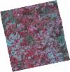
DE2_OPER_HRA_PSH_1C_20210708T110909_N41-925_W008-485_0001
Download Product | Product Info | Browse
Platform Short Name | GEOSAT |
Platform Serial Identifier | 2 |
Product Type | HRA_PSH_1C |
Start Date | 2021-07-08T11:09:09Z |
Stop Date | 2021-07-08T11:09:12Z |
Original Name | DE2_PSH_L1C_000000_20210708T110909_20210708T110912_DE2_38217_4FEB.zip |
Footprint | 41.8720547526 -8.38221749576 42.0030841252 -8.4201568352 41.9783406642 -8.58737184567 41.8469766132 -8.55187165197 41.8720547526 -8.38221749576 |
Orbit Direction | ASCENDING |
Scene Centre Longitude | W008 |
Scene Centre Latitude | N41 |
Cloud Cover Percentage | -1 |
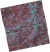
DE2_OPER_HRA_PM4_1C_20210708T110909_N41-925_W008-485_0001
Download Product | Product Info | Browse
Platform Short Name | GEOSAT |
Platform Serial Identifier | 2 |
Product Type | HRA_PM4_1C |
Start Date | 2021-07-08T11:09:09Z |
Stop Date | 2021-07-08T11:09:12Z |
Original Name | DE2_PM4_L1C_000000_20210708T110909_20210708T110912_DE2_38217_4FEB.zip |
Footprint | 41.8720547526 -8.38221749576 42.0030841252 -8.4201568352 41.9783406642 -8.58737184567 41.8469766132 -8.55187165197 41.8720547526 -8.38221749576 |
Orbit Direction | ASCENDING |
Scene Centre Longitude | W008 |
Scene Centre Latitude | N41 |
Cloud Cover Percentage | -1 |
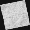
DE2_OPER_HRA_PSH_1C_20210708T110907_N41-806_W008-453_0001
Download Product | Product Info | Browse
Platform Short Name | GEOSAT |
Platform Serial Identifier | 2 |
Product Type | HRA_PSH_1C |
Start Date | 2021-07-08T11:09:07Z |
Stop Date | 2021-07-08T11:09:10Z |
Original Name | DE2_PSH_L1C_000000_20210708T110907_20210708T110910_DE2_38217_1EBD.zip |
Footprint | 41.7527086159 -8.35233955362 41.8841728761 -8.385897407 41.8591493575 -8.55533786894 41.7279915944 -8.51884703032 41.7527086159 -8.35233955362 |
Orbit Direction | ASCENDING |
Scene Centre Longitude | W008 |
Scene Centre Latitude | N41 |
Cloud Cover Percentage | -1 |
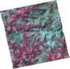
DE2_OPER_HRA_PM4_1C_20210708T110907_N41-806_W008-453_0001
Download Product | Product Info | Browse
Platform Short Name | GEOSAT |
Platform Serial Identifier | 2 |
Product Type | HRA_PM4_1C |
Start Date | 2021-07-08T11:09:07Z |
Stop Date | 2021-07-08T11:09:10Z |
Original Name | DE2_PM4_L1C_000000_20210708T110907_20210708T110910_DE2_38217_1EBD.zip |
Footprint | 41.7527086159 -8.35233955362 41.8841728761 -8.385897407 41.8591493575 -8.55533786894 41.7279915944 -8.51884703032 41.7527086159 -8.35233955362 |
Orbit Direction | ASCENDING |
Scene Centre Longitude | W008 |
Scene Centre Latitude | N41 |
Cloud Cover Percentage | -1 |
DE2_OPER_HRA_PSH_1C_20210406T111300_N41-922_W008-338_0001
Download Product | Product Info | Browse
Platform Short Name | GEOSAT |
Platform Serial Identifier | 2 |
Product Type | HRA_PSH_1C |
Start Date | 2021-04-06T11:13:00Z |
Stop Date | 2021-04-06T11:13:02Z |
Original Name | DE2_PSH_L1C_000000_20210406T111300_20210406T111302_DE2_36837_BB6E.zip |
Footprint | 41.8680419358 -8.23111595195 42.0011366947 -8.27162662295 41.9763398589 -8.44447953263 41.8428915016 -8.40629313944 41.8680419358 -8.23111595195 |
Orbit Direction | ASCENDING |
Scene Centre Longitude | W008 |
Scene Centre Latitude | N41 |
Cloud Cover Percentage | -1 |
DE2_OPER_HRA_PM4_1C_20210406T111300_N41-922_W008-338_0001
Download Product | Product Info | Browse
Platform Short Name | GEOSAT |
Platform Serial Identifier | 2 |
Product Type | HRA_PM4_1C |
Start Date | 2021-04-06T11:13:00Z |
Stop Date | 2021-04-06T11:13:02Z |
Original Name | DE2_PM4_L1C_000000_20210406T111300_20210406T111302_DE2_36837_BB6E.zip |
Footprint | 41.8680419358 -8.23111595195 42.0011366947 -8.27162662295 41.9763398589 -8.44447953263 41.8428915016 -8.40629313944 41.8680419358 -8.23111595195 |
Orbit Direction | ASCENDING |
Scene Centre Longitude | W008 |
Scene Centre Latitude | N41 |
Cloud Cover Percentage | -1 |
DE2_OPER_HRA_PSH_1C_20210318T110701_N41-914_W008-563_0001
Download Product | Product Info | Browse
Platform Short Name | GEOSAT |
Platform Serial Identifier | 2 |
Product Type | HRA_PSH_1C |
Start Date | 2021-03-18T11:07:01Z |
Stop Date | 2021-03-18T11:07:04Z |
Original Name | DE2_PSH_L1C_000000_20210318T110701_20210318T110704_DE2_36555_B774.zip |
Footprint | 41.8648160392 -8.469231119 41.9895784659 -8.50630645275 41.9645758348 -8.65781413122 41.8397617166 -8.62119905876 41.8648160392 -8.469231119 |
Orbit Direction | ASCENDING |
Scene Centre Longitude | W008 |
Scene Centre Latitude | N41 |
Cloud Cover Percentage | -1 |
DE2_OPER_HRA_PM4_1C_20210318T110701_N41-914_W008-563_0001
Download Product | Product Info | Browse
Platform Short Name | GEOSAT |
Platform Serial Identifier | 2 |
Product Type | HRA_PM4_1C |
Start Date | 2021-03-18T11:07:01Z |
Stop Date | 2021-03-18T11:07:04Z |
Original Name | DE2_PM4_L1C_000000_20210318T110701_20210318T110704_DE2_36555_B774.zip |
Footprint | 41.8648160392 -8.469231119 41.9895784659 -8.50630645275 41.9645758348 -8.65781413122 41.8397617166 -8.62119905876 41.8648160392 -8.469231119 |
Orbit Direction | ASCENDING |
Scene Centre Longitude | W008 |
Scene Centre Latitude | N41 |
Cloud Cover Percentage | -1 |
DE2_OPER_HRA_PSH_1C_20210318T110700_N41-801_W008-530_0001
Download Product | Product Info | Browse
Platform Short Name | GEOSAT |
Platform Serial Identifier | 2 |
Product Type | HRA_PSH_1C |
Start Date | 2021-03-18T11:07:00Z |
Stop Date | 2021-03-18T11:07:02Z |
Original Name | DE2_PSH_L1C_000000_20210318T110700_20210318T110702_DE2_36555_9E85.zip |
Footprint | 41.7516435533 -8.43604703241 41.8763169153 -8.47295926257 41.8513168137 -8.62440156983 41.72668333 -8.58715553915 41.7516435533 -8.43604703241 |
Orbit Direction | ASCENDING |
Scene Centre Longitude | W008 |
Scene Centre Latitude | N41 |
Cloud Cover Percentage | -1 |
DE2_OPER_HRA_PM4_1C_20210318T110700_N41-801_W008-530_0001
Download Product | Product Info | Browse
Platform Short Name | GEOSAT |
Platform Serial Identifier | 2 |
Product Type | HRA_PM4_1C |
Start Date | 2021-03-18T11:07:00Z |
Stop Date | 2021-03-18T11:07:02Z |
Original Name | DE2_PM4_L1C_000000_20210318T110700_20210318T110702_DE2_36555_9E85.zip |
Footprint | 41.7516435533 -8.43604703241 41.8763169153 -8.47295926257 41.8513168137 -8.62440156983 41.72668333 -8.58715553915 41.7516435533 -8.43604703241 |
Orbit Direction | ASCENDING |
Scene Centre Longitude | W008 |
Scene Centre Latitude | N41 |
Cloud Cover Percentage | -1 |