ESA TPM Map Catalogue - Product List
back to previous node |
list of download URLs

Collection G2_Portugal_2021
GEOSAT-2 Portugal Coverage 2021 collection. More details here.
List of available products (latitude from 41.7542 to 41.829 dg, longitude from -8.54375 to -8.39938 dg)..
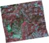
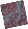
DE2_OPER_HRA_PSH_1C_20211104T111623_N41-855_W008-660_0001
Download Product | Product Info | Browse
Platform Short Name | GEOSAT |
Platform Serial Identifier | 2 |
Product Type | HRA_PSH_1C |
Start Date | 2021-11-04T11:16:23Z |
Stop Date | 2021-11-04T11:16:26Z |
Original Name | DE2_PSH_L1C_000000_20211104T111623_20211104T111626_DE2_39983_0C9D.zip |
Footprint | 41.7925648574 -8.52365409489 41.9455213828 -8.56273689697 41.9191339157 -8.79317413345 41.7654515529 -8.76083383064 41.7925648574 -8.52365409489 |
Orbit Direction | ASCENDING |
Scene Centre Longitude | W008 |
Scene Centre Latitude | N41 |
Cloud Cover Percentage | -1 |
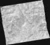
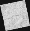
DE2_OPER_HRA_PM4_1C_20211104T111623_N41-855_W008-660_0001
Download Product | Product Info | Browse
Platform Short Name | GEOSAT |
Platform Serial Identifier | 2 |
Product Type | HRA_PM4_1C |
Start Date | 2021-11-04T11:16:23Z |
Stop Date | 2021-11-04T11:16:26Z |
Original Name | DE2_PM4_L1C_000000_20211104T111623_20211104T111626_DE2_39983_0C9D.zip |
Footprint | 41.7925648574 -8.52365409489 41.9455213828 -8.56273689697 41.9191339157 -8.79317413345 41.7654515529 -8.76083383064 41.7925648574 -8.52365409489 |
Orbit Direction | ASCENDING |
Scene Centre Longitude | W008 |
Scene Centre Latitude | N41 |
Cloud Cover Percentage | -1 |
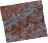
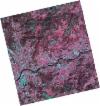
DE2_OPER_HRA_PSH_1C_20211104T111621_N41-716_W008-627_0001
Download Product | Product Info | Browse
Platform Short Name | GEOSAT |
Platform Serial Identifier | 2 |
Product Type | HRA_PSH_1C |
Start Date | 2021-11-04T11:16:21Z |
Stop Date | 2021-11-04T11:16:24Z |
Original Name | DE2_PSH_L1C_000000_20211104T111621_20211104T111624_DE2_39983_20A5.zip |
Footprint | 41.6533458391 -8.49231805434 41.8065706467 -8.52911205043 41.778743542 -8.76295041197 41.6265311906 -8.72606290868 41.6533458391 -8.49231805434 |
Orbit Direction | ASCENDING |
Scene Centre Longitude | W008 |
Scene Centre Latitude | N41 |
Cloud Cover Percentage | -1 |
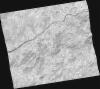
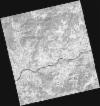
DE2_OPER_HRA_PM4_1C_20211104T111621_N41-716_W008-627_0001
Download Product | Product Info | Browse
Platform Short Name | GEOSAT |
Platform Serial Identifier | 2 |
Product Type | HRA_PM4_1C |
Start Date | 2021-11-04T11:16:21Z |
Stop Date | 2021-11-04T11:16:24Z |
Original Name | DE2_PM4_L1C_000000_20211104T111621_20211104T111624_DE2_39983_20A5.zip |
Footprint | 41.6533458391 -8.49231805434 41.8065706467 -8.52911205043 41.778743542 -8.76295041197 41.6265311906 -8.72606290868 41.6533458391 -8.49231805434 |
Orbit Direction | ASCENDING |
Scene Centre Longitude | W008 |
Scene Centre Latitude | N41 |
Cloud Cover Percentage | -1 |
DE2_OPER_HRA_PSH_1C_20210708T110907_N41-806_W008-453_0001
Download Product | Product Info | Browse
Platform Short Name | GEOSAT |
Platform Serial Identifier | 2 |
Product Type | HRA_PSH_1C |
Start Date | 2021-07-08T11:09:07Z |
Stop Date | 2021-07-08T11:09:10Z |
Original Name | DE2_PSH_L1C_000000_20210708T110907_20210708T110910_DE2_38217_1EBD.zip |
Footprint | 41.7527086159 -8.35233955362 41.8841728761 -8.385897407 41.8591493575 -8.55533786894 41.7279915944 -8.51884703032 41.7527086159 -8.35233955362 |
Orbit Direction | ASCENDING |
Scene Centre Longitude | W008 |
Scene Centre Latitude | N41 |
Cloud Cover Percentage | -1 |
DE2_OPER_HRA_PM4_1C_20210708T110907_N41-806_W008-453_0001
Download Product | Product Info | Browse
Platform Short Name | GEOSAT |
Platform Serial Identifier | 2 |
Product Type | HRA_PM4_1C |
Start Date | 2021-07-08T11:09:07Z |
Stop Date | 2021-07-08T11:09:10Z |
Original Name | DE2_PM4_L1C_000000_20210708T110907_20210708T110910_DE2_38217_1EBD.zip |
Footprint | 41.7527086159 -8.35233955362 41.8841728761 -8.385897407 41.8591493575 -8.55533786894 41.7279915944 -8.51884703032 41.7527086159 -8.35233955362 |
Orbit Direction | ASCENDING |
Scene Centre Longitude | W008 |
Scene Centre Latitude | N41 |
Cloud Cover Percentage | -1 |
DE2_OPER_HRA_PSH_1C_20210318T110700_N41-801_W008-530_0001
Download Product | Product Info | Browse
Platform Short Name | GEOSAT |
Platform Serial Identifier | 2 |
Product Type | HRA_PSH_1C |
Start Date | 2021-03-18T11:07:00Z |
Stop Date | 2021-03-18T11:07:02Z |
Original Name | DE2_PSH_L1C_000000_20210318T110700_20210318T110702_DE2_36555_9E85.zip |
Footprint | 41.7516435533 -8.43604703241 41.8763169153 -8.47295926257 41.8513168137 -8.62440156983 41.72668333 -8.58715553915 41.7516435533 -8.43604703241 |
Orbit Direction | ASCENDING |
Scene Centre Longitude | W008 |
Scene Centre Latitude | N41 |
Cloud Cover Percentage | -1 |
DE2_OPER_HRA_PM4_1C_20210318T110700_N41-801_W008-530_0001
Download Product | Product Info | Browse
Platform Short Name | GEOSAT |
Platform Serial Identifier | 2 |
Product Type | HRA_PM4_1C |
Start Date | 2021-03-18T11:07:00Z |
Stop Date | 2021-03-18T11:07:02Z |
Original Name | DE2_PM4_L1C_000000_20210318T110700_20210318T110702_DE2_36555_9E85.zip |
Footprint | 41.7516435533 -8.43604703241 41.8763169153 -8.47295926257 41.8513168137 -8.62440156983 41.72668333 -8.58715553915 41.7516435533 -8.43604703241 |
Orbit Direction | ASCENDING |
Scene Centre Longitude | W008 |
Scene Centre Latitude | N41 |
Cloud Cover Percentage | -1 |
DE2_OPER_HRA_PSH_1C_20210318T110658_N41-688_W008-496_0001
Download Product | Product Info | Browse
Platform Short Name | GEOSAT |
Platform Serial Identifier | 2 |
Product Type | HRA_PSH_1C |
Start Date | 2021-03-18T11:06:58Z |
Stop Date | 2021-03-18T11:07:00Z |
Original Name | DE2_PSH_L1C_000000_20210318T110658_20210318T110700_DE2_36555_FA12.zip |
Footprint | 41.6386253763 -8.40230032703 41.7632449567 -8.4393469851 41.7382601708 -8.59044554621 41.6136486461 -8.55358937878 41.6386253763 -8.40230032703 |
Orbit Direction | ASCENDING |
Scene Centre Longitude | W008 |
Scene Centre Latitude | N41 |
Cloud Cover Percentage | -1 |
DE2_OPER_HRA_PM4_1C_20210318T110658_N41-688_W008-496_0001
Download Product | Product Info | Browse
Platform Short Name | GEOSAT |
Platform Serial Identifier | 2 |
Product Type | HRA_PM4_1C |
Start Date | 2021-03-18T11:06:58Z |
Stop Date | 2021-03-18T11:07:00Z |
Original Name | DE2_PM4_L1C_000000_20210318T110658_20210318T110700_DE2_36555_FA12.zip |
Footprint | 41.6386253763 -8.40230032703 41.7632449567 -8.4393469851 41.7382601708 -8.59044554621 41.6136486461 -8.55358937878 41.6386253763 -8.40230032703 |
Orbit Direction | ASCENDING |
Scene Centre Longitude | W008 |
Scene Centre Latitude | N41 |
Cloud Cover Percentage | -1 |