ESA TPM Map Catalogue - Product List
back to previous node |
list of download URLs

Collection G2_Portugal_2021
GEOSAT-2 Portugal Coverage 2021 collection. More details here.
List of available products (latitude from 41.5296 to 41.6044 dg, longitude from -8.68812 to -8.54375 dg)..
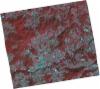
DE2_OPER_HRA_PSH_1C_20211104T111618_N41-577_W008-595_0001
Download Product | Product Info | Browse
Platform Short Name | GEOSAT |
Platform Serial Identifier | 2 |
Product Type | HRA_PSH_1C |
Start Date | 2021-11-04T11:16:18Z |
Stop Date | 2021-11-04T11:16:21Z |
Original Name | DE2_PSH_L1C_000000_20211104T111618_20211104T111621_DE2_39983_DA0F.zip |
Footprint | 41.5141019342 -8.46105997525 41.6674304756 -8.49685618739 41.6407385667 -8.72921773144 41.4873271149 -8.69392933689 41.5141019342 -8.46105997525 |
Orbit Direction | ASCENDING |
Scene Centre Longitude | W008 |
Scene Centre Latitude | N41 |
Cloud Cover Percentage | -1 |
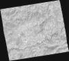
DE2_OPER_HRA_PM4_1C_20211104T111618_N41-577_W008-595_0001
Download Product | Product Info | Browse
Platform Short Name | GEOSAT |
Platform Serial Identifier | 2 |
Product Type | HRA_PM4_1C |
Start Date | 2021-11-04T11:16:18Z |
Stop Date | 2021-11-04T11:16:21Z |
Original Name | DE2_PM4_L1C_000000_20211104T111618_20211104T111621_DE2_39983_DA0F.zip |
Footprint | 41.5141019342 -8.46105997525 41.6674304756 -8.49685618739 41.6407385667 -8.72921773144 41.4873271149 -8.69392933689 41.5141019342 -8.46105997525 |
Orbit Direction | ASCENDING |
Scene Centre Longitude | W008 |
Scene Centre Latitude | N41 |
Cloud Cover Percentage | -1 |
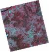
DE2_OPER_HRA_PSH_1C_20210525T110207_N41-659_W008-657_0001
Download Product | Product Info | Browse
Platform Short Name | GEOSAT |
Platform Serial Identifier | 2 |
Product Type | HRA_PSH_1C |
Start Date | 2021-05-25T11:02:07Z |
Stop Date | 2021-05-25T11:02:10Z |
Original Name | DE2_PSH_L1C_000000_20210525T110207_20210525T110210_DE2_37564_8A4E.zip |
Footprint | 41.6108330508 -8.56452745808 41.7336821511 -8.60257747197 41.7081298118 -8.74991293039 41.5852539579 -8.71167894404 41.6108330508 -8.56452745808 |
Orbit Direction | ASCENDING |
Scene Centre Longitude | W008 |
Scene Centre Latitude | N41 |
Cloud Cover Percentage | -1 |
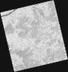
DE2_OPER_HRA_PM4_1C_20210525T110207_N41-659_W008-657_0001
Download Product | Product Info | Browse
Platform Short Name | GEOSAT |
Platform Serial Identifier | 2 |
Product Type | HRA_PM4_1C |
Start Date | 2021-05-25T11:02:07Z |
Stop Date | 2021-05-25T11:02:10Z |
Original Name | DE2_PM4_L1C_000000_20210525T110207_20210525T110210_DE2_37564_8A4E.zip |
Footprint | 41.6108330508 -8.56452745808 41.7336821511 -8.60257747197 41.7081298118 -8.74991293039 41.5852539579 -8.71167894404 41.6108330508 -8.56452745808 |
Orbit Direction | ASCENDING |
Scene Centre Longitude | W008 |
Scene Centre Latitude | N41 |
Cloud Cover Percentage | -1 |
DE2_OPER_HRA_PSH_1C_20210525T110206_N41-548_W008-622_0001
Download Product | Product Info | Browse
Platform Short Name | GEOSAT |
Platform Serial Identifier | 2 |
Product Type | HRA_PSH_1C |
Start Date | 2021-05-25T11:02:06Z |
Stop Date | 2021-05-25T11:02:08Z |
Original Name | DE2_PSH_L1C_000000_20210525T110206_20210525T110208_DE2_37564_C4FE.zip |
Footprint | 41.4993946133 -8.53027463206 41.6222226276 -8.56808803277 41.5966590859 -8.71514696586 41.4738780569 -8.6771236313 41.4993946133 -8.53027463206 |
Orbit Direction | ASCENDING |
Scene Centre Longitude | W008 |
Scene Centre Latitude | N41 |
Cloud Cover Percentage | -1 |
DE2_OPER_HRA_PM4_1C_20210525T110206_N41-548_W008-622_0001
Download Product | Product Info | Browse
Platform Short Name | GEOSAT |
Platform Serial Identifier | 2 |
Product Type | HRA_PM4_1C |
Start Date | 2021-05-25T11:02:06Z |
Stop Date | 2021-05-25T11:02:08Z |
Original Name | DE2_PM4_L1C_000000_20210525T110206_20210525T110208_DE2_37564_C4FE.zip |
Footprint | 41.4993946133 -8.53027463206 41.6222226276 -8.56808803277 41.5966590859 -8.71514696586 41.4738780569 -8.6771236313 41.4993946133 -8.53027463206 |
Orbit Direction | ASCENDING |
Scene Centre Longitude | W008 |
Scene Centre Latitude | N41 |
Cloud Cover Percentage | -1 |